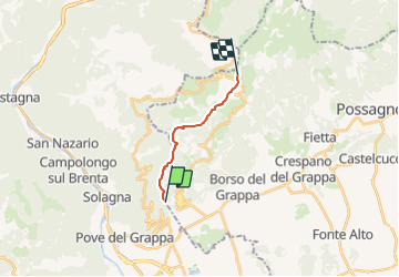
![](/images/other/stat-length.png)
![Randonnée A pied Borso del Grappa - IT-180 - Photo](https://media.geolcdn.com/t/1900/400/ext.pjpeg?maxdim=2&url=https%3A%2F%2Fmedia.geolcdn.com%2Ff%2Fb91c6cf6-b37f-4efc-ab03-80e200f4e2b2.jpeg)
IT-180
SityTrail - itinéraires balisés pédestres
Tous les sentiers balisés d’Europe PRO
![Longueur](/images/other/stat-length.png)
Longueur
9,4 km
![Altitude max](https://static1.geolcdn.com/siteimages/upload/files/1508320355ic_sort_altitude_max_24dp.png)
Altitude max
1730 m
![Dénivelé positif](https://static1.geolcdn.com/siteimages/upload/files/1508320355ic_sort_den_pos_24dp.png)
Dénivelé positif
1458 m
![Km-Effort](/images/other/stat-length.png)
Km-Effort
24 km
![Altitude min](https://static1.geolcdn.com/siteimages/upload/files/1508320355ic_sort_altitude_min_24dp.png)
Altitude min
266 m
![Dénivelé négatif](https://static1.geolcdn.com/siteimages/upload/files/1508320355ic_sort_den_neg_24dp.png)
Dénivelé négatif
4 m
![Boucle](https://static1.geolcdn.com/siteimages/upload/files/16400158638029165_repeat_loop_refresh_sync_direction_icon.png)
Boucle
Non
Balise
Date de création :
2022-02-15 05:08:04.826
Dernière modification :
2022-03-01 02:56:58.545
![A pied](https://static1.geolcdn.com/sitytour/trail-icons/100.png)
5h27
Difficulté : Moyen
![Scannez ce code QR pour ouvrir la randonnée dans l'application SityTrail](https://capi.geolives.com/qq0zvz2zws4bq2lad0pu/sitytour/trails/3115618/qr.png?size=200)
Application GPS de randonnée GRATUITE
À propos
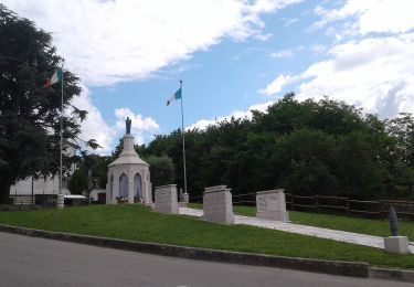
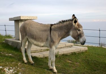
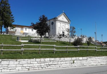
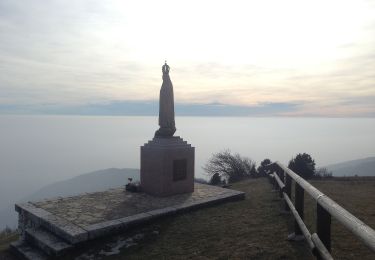
Randonnée A pied de 9,4 km à découvrir à Vénétie, Treviso, Borso del Grappa. Cette randonnée est proposée par SityTrail - itinéraires balisés pédestres.
Description
Randonnée créée par CAI.
Symbole: 180 on white red flag
Site web: http://www.caibassanograppa.com
Localisation
Pays :
Italie
Région :
Vénétie
Département/Province :
Treviso
Commune :
Borso del Grappa
Localité :
Unknown
Départ:(Dec)
Départ:(UTM)
714003 ; 5077122 (32T) N.
Commentaires
Randonnées à proximité
![Randonnée A pied Mussolente - Le Volpere - Photo](https://media.geolcdn.com/t/375/260/ext.jpg?maxdim=2&url=https%3A%2F%2Fmedia.geolcdn.com%2Ff%2F25732017-1623-4ebb-86bd-16bee4428640.jpeg)
![A pied A pied](https://static1.geolcdn.com/sitytour/trail-icons/100.png)
![Randonnée A pied Solagna - IT-940 - Photo](https://media.geolcdn.com/t/375/260/ext.jpg?maxdim=2&url=https%3A%2F%2Fmedia.geolcdn.com%2Ff%2F0f4ab9ed-0de7-4cf1-8475-a5e1dbf7d1b5.jpeg)
![A pied A pied](https://static1.geolcdn.com/sitytour/trail-icons/100.png)
![Randonnée A pied Borso del Grappa - IT-100 - Photo](https://media.geolcdn.com/t/375/260/ext.jpg?maxdim=2&url=https%3A%2F%2Fmedia.geolcdn.com%2Ff%2Fb91c6cf6-b37f-4efc-ab03-80e200f4e2b2.jpeg)
![A pied A pied](https://static1.geolcdn.com/sitytour/trail-icons/100.png)
![Randonnée A pied Bassano del Grappa - San Michele - Valrovina - Rubbio - Photo](https://media.geolcdn.com/t/375/260/ext.jpg?maxdim=2&url=https%3A%2F%2Fmedia.geolcdn.com%2Ff%2F701efe39-a3e4-4143-b80c-f9367bbd622e.jpeg)
![A pied A pied](https://static1.geolcdn.com/sitytour/trail-icons/100.png)
San Michele - Valrovina - Rubbio
A pied
Facile
Bassano del Grappa,
Vénétie,
Vicenza,
Italie
![](/images/other/stat-length.png)
6,5 km | 15,2 km-effort
3h 27min
![](https://static1.geolcdn.com/siteimages/upload/files/16400158638029165_repeat_loop_refresh_sync_direction_icon.png)
Non
![Randonnée A pied Valbrenta - Campolongo sul Brenta - Casare di Campolongo - Monte Campolongo - Photo](https://media.geolcdn.com/t/375/260/ext.jpg?maxdim=2&url=https%3A%2F%2Fmedia.geolcdn.com%2Ff%2F019c7c09-5872-4fe3-b255-5652a802112b.jpeg)
![A pied A pied](https://static1.geolcdn.com/sitytour/trail-icons/100.png)
Campolongo sul Brenta - Casare di Campolongo - Monte Campolongo
A pied
Facile
Valbrenta,
Vénétie,
Vicenza,
Italie
![](/images/other/stat-length.png)
5,7 km | 15,8 km-effort
3h 35min
![](https://static1.geolcdn.com/siteimages/upload/files/16400158638029165_repeat_loop_refresh_sync_direction_icon.png)
Non
![Randonnée A pied Bassano del Grappa - Campese - Bocchetta Campesana - Monte Caina - Photo](https://media.geolcdn.com/t/375/260/ext.jpg?maxdim=2&url=https%3A%2F%2Fmedia.geolcdn.com%2Ff%2Fb5114b3f-7e87-431e-a5a2-28207aeb60f1.jpeg)
![A pied A pied](https://static1.geolcdn.com/sitytour/trail-icons/100.png)
Campese - Bocchetta Campesana - Monte Caina
A pied
Facile
Bassano del Grappa,
Vénétie,
Vicenza,
Italie
![](/images/other/stat-length.png)
4,4 km | 13,4 km-effort
3h 2min
![](https://static1.geolcdn.com/siteimages/upload/files/16400158638029165_repeat_loop_refresh_sync_direction_icon.png)
Non
![Randonnée A pied Borso del Grappa - IT-197 - Photo](https://media.geolcdn.com/t/375/260/ext.jpg?maxdim=2&url=https%3A%2F%2Fmedia.geolcdn.com%2Ff%2F9deb1683-b3fd-42e9-9a96-07b3b58c0cfc.jpeg)
![A pied A pied](https://static1.geolcdn.com/sitytour/trail-icons/100.png)
![Randonnée A pied Borso del Grappa - IT-196 - Photo](https://media.geolcdn.com/t/375/260/ext.jpg?maxdim=2&url=https%3A%2F%2Fmedia.geolcdn.com%2Ff%2F9deb1683-b3fd-42e9-9a96-07b3b58c0cfc.jpeg)
![A pied A pied](https://static1.geolcdn.com/sitytour/trail-icons/100.png)
![Randonnée A pied Borso del Grappa - IT-102 - Photo](https://media.geolcdn.com/t/375/260/ext.jpg?maxdim=2&url=https%3A%2F%2Fmedia.geolcdn.com%2Ff%2F72968365-b61e-4496-9274-21e80fe28a9c.jpeg)
![A pied A pied](https://static1.geolcdn.com/sitytour/trail-icons/100.png)